

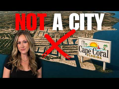
There's a video going around with millions of views calling Cape Coral the worst designed city in America. Cul-de-sacs everywhere, no real downtown, canals people call moats. And honestly, the complaints aren't made up.
What almost every one of those videos leaves out is the reason. Cape Coral wasn't designed like a city because it was never meant to be one, at least not at first. It was designed to sell land. Once you know that, every "flaw" people point to makes a completely different kind of sense.
I sell real estate here, I moved here from Denver myself, and Vic and I dealt with real flooding at our own place during Hurricane Ian. So this isn't a hit piece and it isn't a sales pitch. It's the seven biggest design complaints, why each one exists, and what it actually means if you're thinking about moving here.
Why doesn't Cape Coral have sidewalks?
Because the original roads were built without them. Outside the downtown core, a lot of Cape Coral's streets were laid out with no sidewalk and no shoulder, period. It's flat and sunny and should be one of the most walkable cities in Florida, and instead plenty of neighborhoods still don't have a safe way to walk to the mailbox.
It matters for kids, too. Florida only funds school busing for students who live more than two miles from campus, and in a lot of Cape Coral neighborhoods most families live well inside that line. That means kids are expected to walk or bike on streets that were never built for it.
The good news is the city knows. Cape Coral has spent the last several years retrofitting streets, adding sidewalks and turning extra travel lanes into walking and bike paths. In the city's resident survey, approval for ease of walking and biking went up by double digits between 2019 and 2021, and the city picked up a national award for the turnaround.
But notice what that is: the city spending real tax dollars undoing a decision that was never really theirs. It was a gap the original developer left for somebody else to fix.
How to check before you buy: sidewalk coverage here isn't a zip code fact. It can change from one street to the next. Pull the address up on street view, then drive the block at the time of day you'd actually be out walking. Treat it like the flood zone, specific to that house.
Why is downtown Cape Coral so small?
Because nobody planned for one. Cape Coral has well over 200,000 people now, and the downtown on SE 47th Terrace is still small, with surface parking and empty land in the middle of it. Every time the city tries to grow it, it runs straight into residential neighborhoods that were platted decades ago with zero room built in.
If you've watched my videos on the newer developments, this is the same story over and over. Bimini Basin, the Yacht Club, projects that take years and get rethought along the way. That's not bad luck. The original plan never set aside space for a real downtown or real public gathering spots, so every attempt to build one now has to fight the plan that's already on the ground.
The Yacht Club rebuild is a good example. The plans cover a parking garage, a community center, a pool, docks, a fishing pier and beach restrooms, all on one piece of shoreline, and the city is building it in phases. That's a lot for one park to carry, because it's standing in for sixty years of missing public space.
There's a quieter cost too. A real downtown means offices, shops and hotels on the tax rolls, helping pay for city services. Without one, more of that weight lands on residential property taxes. A thin downtown isn't just a walkability problem. It's a budget problem wearing a walkability costume. (If that's on your mind, the property tax simulator is a good place to run your own numbers.)
Why are there so many empty lots in Cape Coral?
Because the lots were sold before the people showed up. Drive around the Cape and you'll see a finished, well kept home right next to an overgrown empty rectangle, then another one two doors down. Some of those lots get bought, sit for years or decades, and get resold without a house ever going up.
When the land was platted, it wasn't platted to match a population that already lived here. It was platted into individual lots to sell to buyers up north, many of whom never planned to move to Florida at all. For a lot of the earliest buyers it was a paper transaction, a piece of the Florida dream mailed to their door. Cape Coral has spent more than sixty years slowly catching up to a lot count that was drawn on a map in the late 1950s, and some pockets are honestly still catching up.
That's also why builders and investors keep circling back. There are still more buildable lots on the map than homes built on them, which is infill opportunity the rest of Southwest Florida ran out of a long time ago.
If you're buying a lot: don't assume water, sewer and electric are sitting at the property line just because it's been platted forever. Confirm utilities before you count on a quick build.
Are Cape Coral's canals really a design flaw?
Partly, and partly they're the reason this place works at all. Cape Coral has more than 400 miles of canals, more navigable waterway than any city in the world. It's the whole selling point. It also means two houses that are practically neighbors can be separated by water, so a five minute walk turns into a twenty minute drive around. In an emergency, that's extra minutes for a fire truck or ambulance looping the long way.
What most of these videos skip: the dirt dug out of those canals was used to raise the lots next to them above the natural swamp grade. The canals weren't purely for looks. They were part of the original drainage and flood control.
That doesn't mean flood risk here is low, and it's definitely not the same everywhere. Your actual insurance premium comes down to your specific elevation certificate, not a city-wide average. I put together a hurricane guide that walks through how to check your real, street-level picture before you buy, and the flood section of the relocation guide covers the basics.
A few more things worth knowing before you fall in love with a canal photo:
- Seawalls don't last forever. Every waterfront lot has one, and budgeting for eventual repair or replacement is part of owning on the water here, not a surprise.
- Not all waterfront is equal. Gulf access, direct access, non-direct access and sailboat access are very different properties. A low fixed bridge between you and open water changes everything, even if the two homes are around the corner from each other. The canal guide breaks it down.
- If it's a rental, flood insurance is a real line item that changes your return. Run it through the rental calculator before you fall in love with the view, not after.
Why is Cape Coral laid out on a grid with such busy roads?
Because a grid is the easiest shape to survey, plat and sell. Cape Coral runs on a strict grid with a handful of wide, fast roads carrying most of the traffic: Pine Island Road, Santa Barbara Boulevard, Del Prado Boulevard. They're lined with shopping centers, driveways and turn lanes. Urban planners call that combination a stroad, a street and a road mashed together that does neither job well. Too slow and cluttered to move traffic, too fast and wide to feel good on foot or a bike.
Think of it like a spreadsheet instead of a hand drawn map. Rows and columns are fast to fill in and easy to sell one cell at a time, but nobody designs a spreadsheet worrying about how it'll feel to walk across later. The same efficiency that made this land easy to sell by the thousands is what makes it clumsy to drive today, and it's the same traffic tension showing up in the newer development fights.
Is Cape Coral the only Florida city built this way?
No, and this is the detail that changes how you should think about all of it. The company behind Cape Coral, Gulf American, used the same playbook elsewhere: buy cheap Florida swampland, plat it into a grid of lots, dig canals or grade roads, and sell it to buyers up north who'd never seen it. The most famous example is Golden Gate Estates over in Collier County, one of the best known pre-platted land developments in the country.
Thin services, too many lots, roads that came after the plats...you'll find the same complaints across a whole generation of Florida communities built in the 1950s and 60s by land sales companies running versions of the same model. Cape Coral isn't a uniquely bad plan. It's an especially large, especially well preserved example of a business model an entire industry ran at the same time.
Nobody accidentally repeats the same mistake in multiple counties. You repeat a formula because it's working for whoever's selling.
Who actually designed Cape Coral, and what was it built for?
Two brothers from Baltimore, Leonard and Jack Rosen. In 1957 they bought a huge tract of Southwest Florida swamp for about $678,000. There were no roads, no utilities and no residents. Instead of building a city the usual way, infrastructure first and houses second, they platted the land into individual lots before a single road or pipe existed.
Then they dredged canals through it, hundreds of miles of them, to turn ordinary inland lots into waterfront lots, because waterfront sold at a premium. The canals were as much a sales tool as anything else.
Their company also helped pioneer buying land on an installment plan. Instead of paying the full price up front, a middle class family in Ohio or New York could put down a small deposit and pay monthly, which meant almost anyone could say yes. Add free flights and meals to come see the property in person, and Gulf American became the largest land sales company in the country through the late 1950s and 60s.
That same high pressure sales machine also got them in real trouble. In 1967 the state went after the company over how lots were being marketed, and it ended up pleading guilty to charges of misleading sales practices. The success and the scrutiny came from the exact same playbook.
So is Cape Coral badly designed? Judged as a city, on walkability, connectivity and downtown, yes, by most modern planning standards it struggles. But it was never designed as a city. It was designed as a machine for turning swampland into one of the most successful land sales operations in American history, and it worked.
What this means if you're moving here
No sidewalks, because the plan was never built around walking. A tiny downtown, because it was never built around commerce. Empty lots, because it sold population it didn't have yet. Canals that cut you off from your neighbor, because it was built to sell waterfront. A grid full of stroads, because that's what you draw when you're selling, not engineering traffic.
"Worst designed city in America" and "one of the most successful land sales operations in American history" aren't two different stories. They're the same story told from two angles. The plan didn't fail. It just wasn't a plan for what everyone assumes.
If you already live here, none of this is news. You know which streets don't have sidewalks and which canal lot needed a new seawall last year. What's changing is that the city is finally treating the gaps in the original plan as things to fix, sidewalk by sidewalk and block by block downtown. The Cape you'd be moving to today isn't frozen in 1957.
If you want the real picture of what you'd be walking into, not the sales pitch and not the viral hit piece, that's exactly what the free relocation guide is for. It's everything I wish someone had handed me before I moved down here. And if you'd rather just ask, we'll tell you honestly.
[[cta Read the relocation guide|/guide]] [[cta Text us|sms:+12394454151]]